
Trusted by clients across 25+ countries
Geoinformatics is a multidisciplinary geospatial services company offering LiDAR processing, GIS, photogrammetry, and spatial data solutions to clients across the globe.
From raw point cloud to analysis-ready products — we deliver precision at every stage of the geospatial workflow.

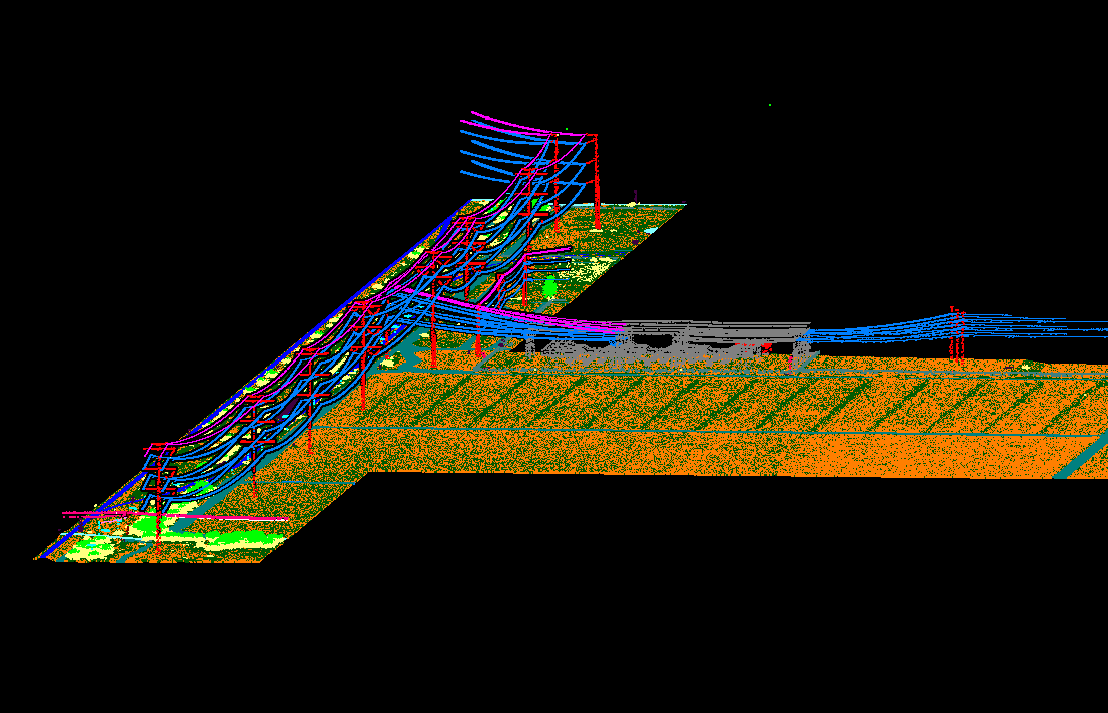
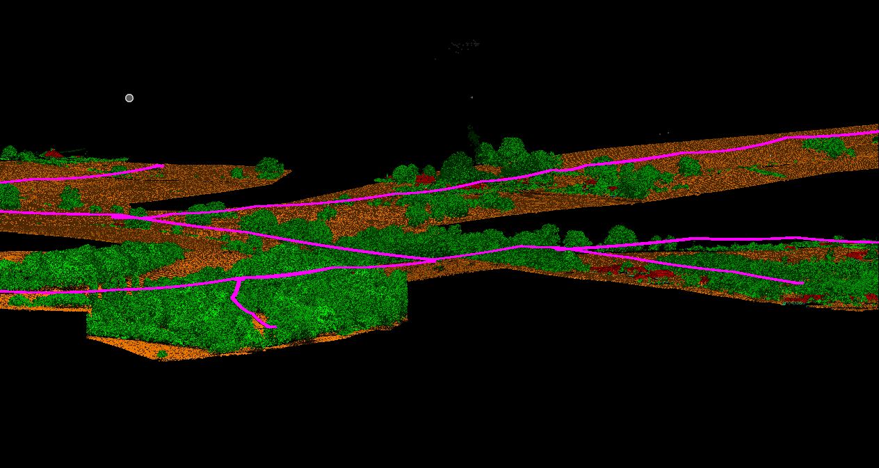
Comprehensive LiDAR point cloud processing from strip adjustment through to final classified deliverables.

Precision aerial triangulation, 3D city modelling, and ortho-photo production for mapping applications.

Topographic, cadastral, and thematic mapping with geospatial database design and GPS survey.

High-quality ortho generation, mosaicing, colour balancing, seamline editing and tile cutting services.

3D modelling, BIM/MEP, reverse engineering and surface texturing using terrestrial and mobile laser scanning.

Engineering drawing conversion, drafting bureau services, and raster-to-digital data conversion across Civil, Structural, MEP and Architecture verticals.
Our vertical focus spans the sectors that rely most on accurate spatial intelligence to make critical decisions.
GIS solutions for cadastral and land-use mapping for state governments, municipalities and urban planning institutions.
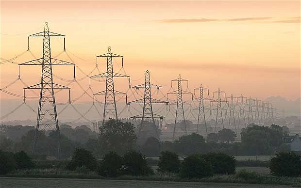
Spatial and non-spatial data management for electric, gas, water and telecom utilities — geodatabases with asset and facility data.

Pipeline corridor mapping, facility management GIS, and geospatial integration for energy infrastructure projects.
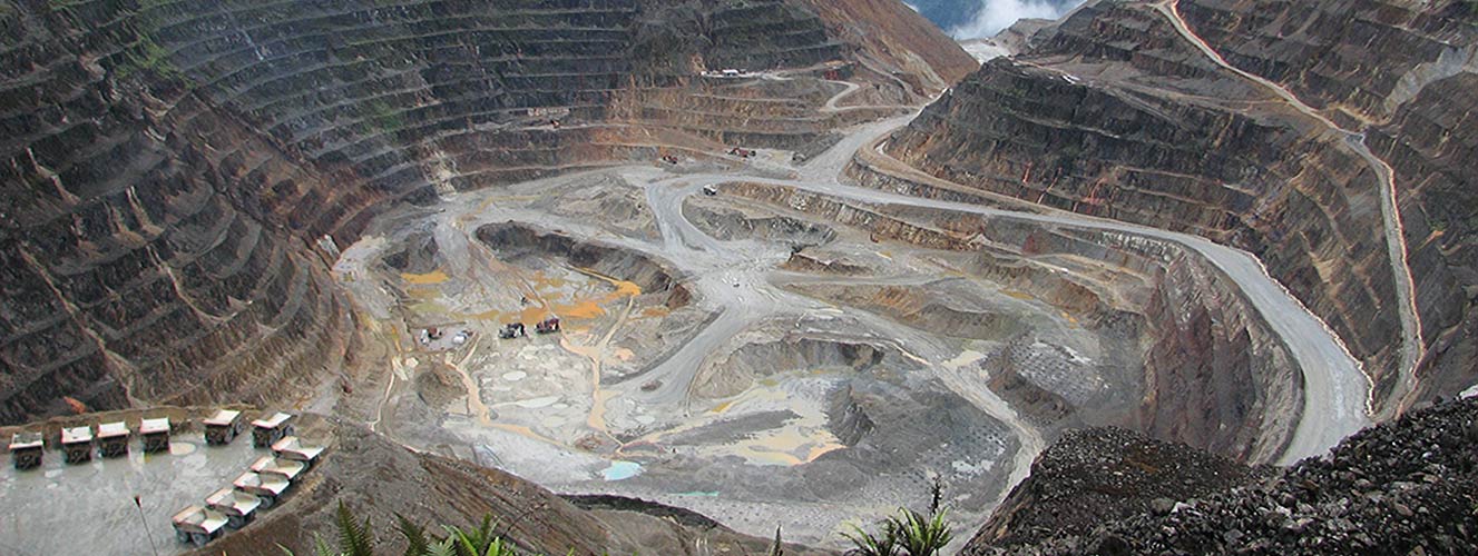
Surface/sub-surface mineral mapping, drill log digitization, geological geo-databases, and mine-site terrain mapping.

GIS-based navigation content creation, network mapping, and flawless geodata content services for the navigation industry.
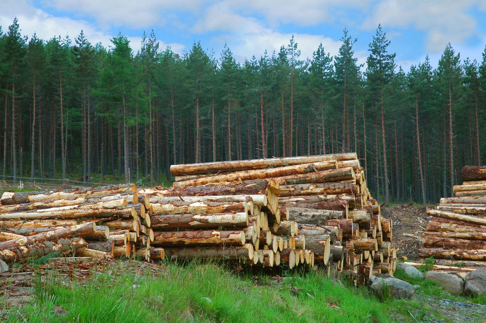
Forest inventory data collection using LiDAR, vegetation analysis, fire mitigation mapping and fallen log measurement.
Delivering accurate geospatial solutions across Australia, North America, Brazil and beyond.
Automated ground classification and hydro feature / atmospheric noise classification.
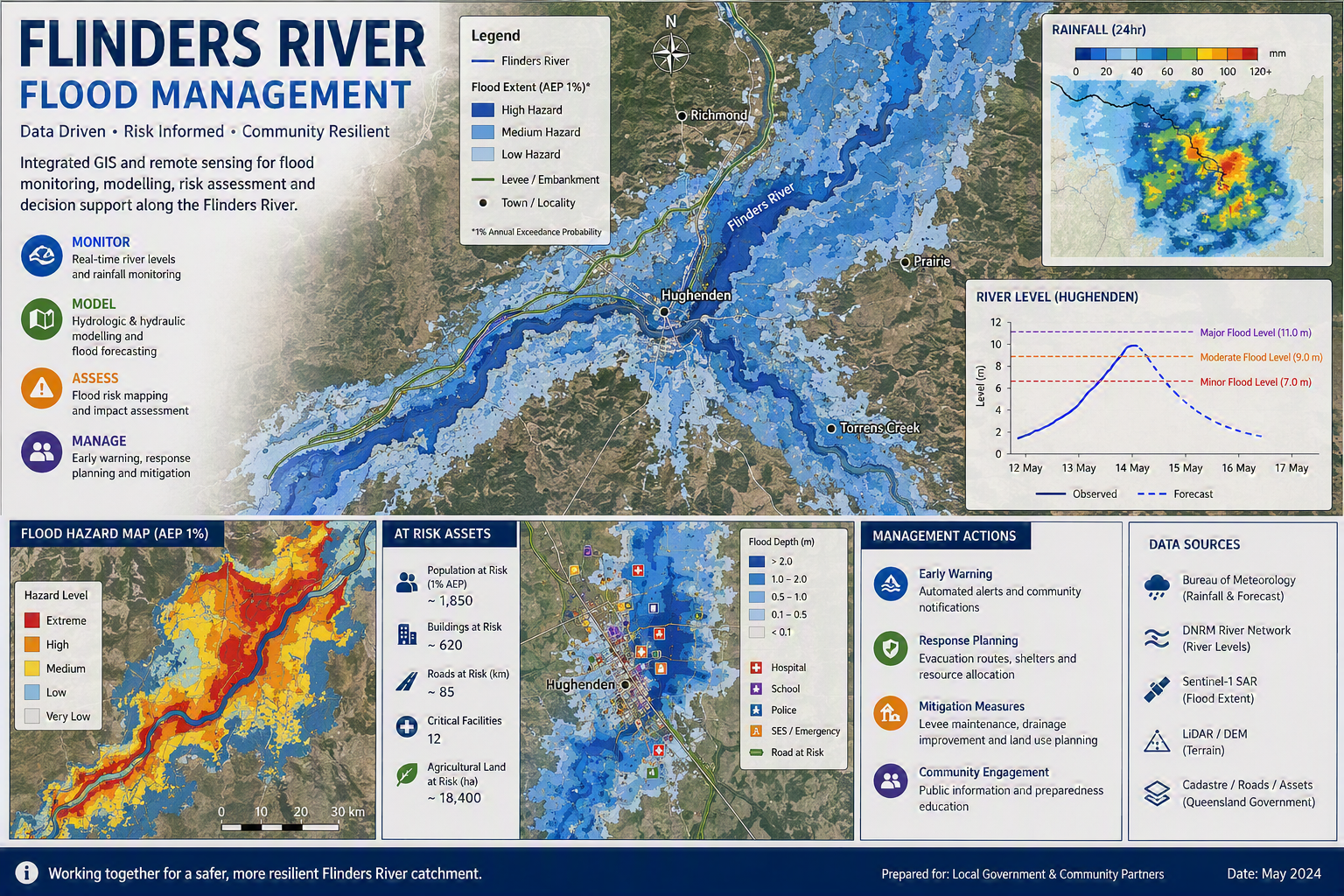
Ground, hydro, building and artifacts classification for large-scale flood risk assessment.
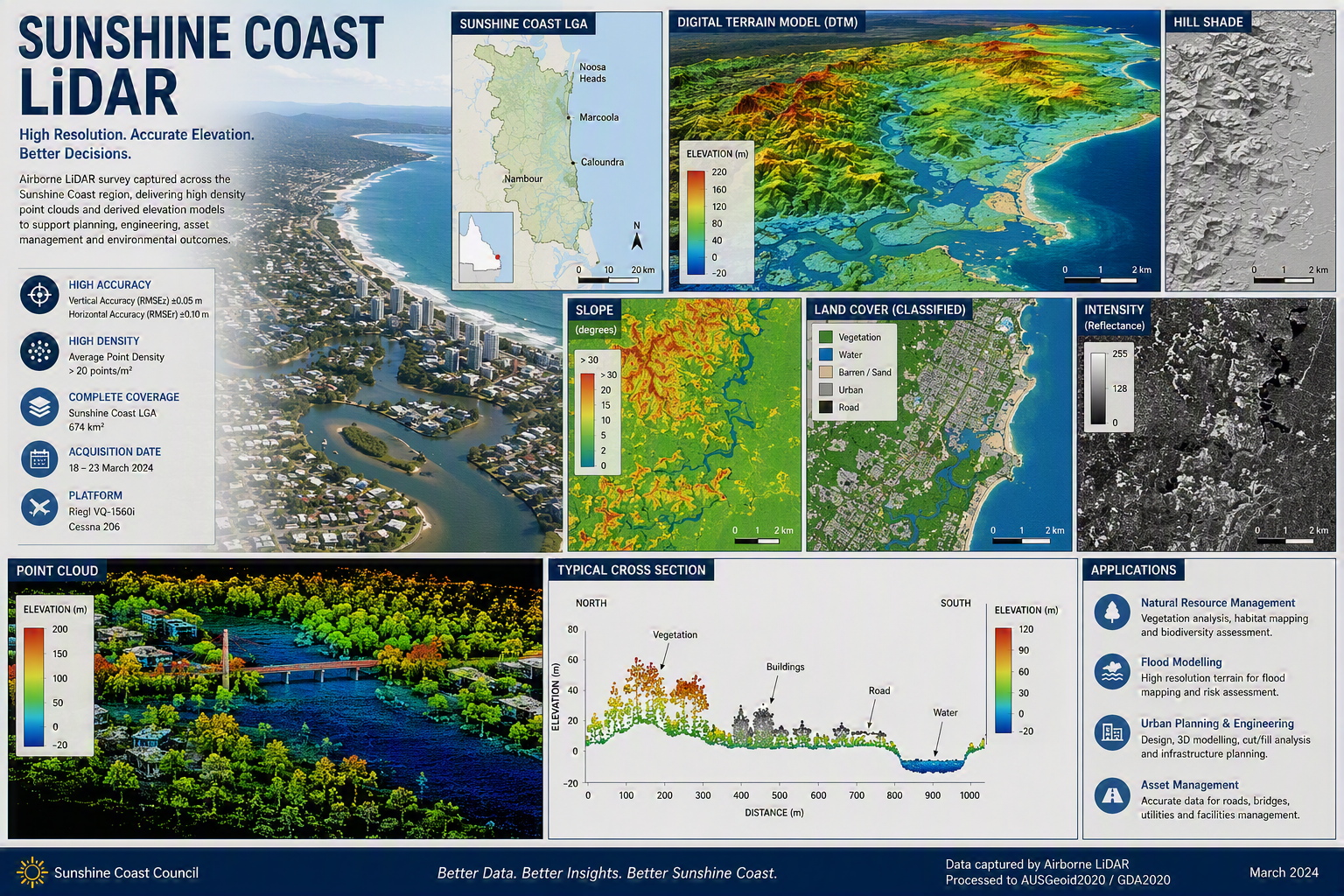
Full classification suite plus 3D breakline digitization across Queensland coastal corridor.
Powerline classification and danger object detection for transmission corridor safety.
Largest project in portfolio — full classification suite for Victorian digital terrain model.
Ground classification, hydro feature and atmospheric noise processing for open-cut mine site.
LiDAR classification of ground and vegetation; vector capture of fallen woody logs with length and diameter measurement.
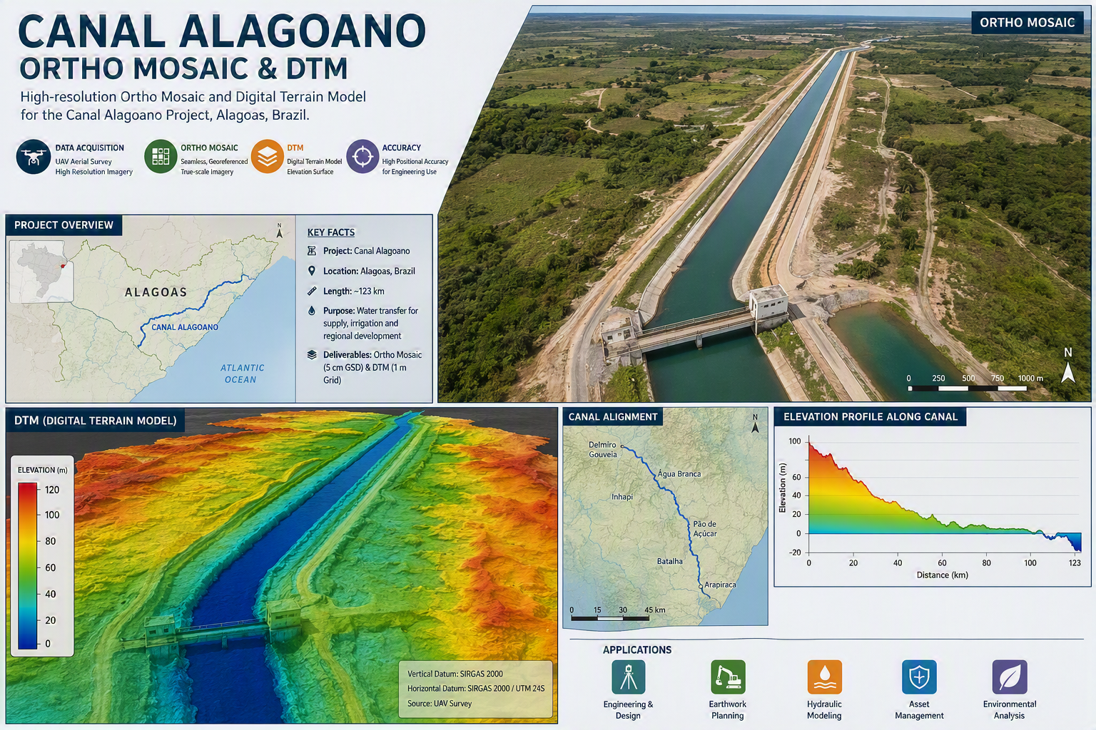
Ortho mosaic and DTM creation from 13,000 drone images over a Brazilian canal corridor.
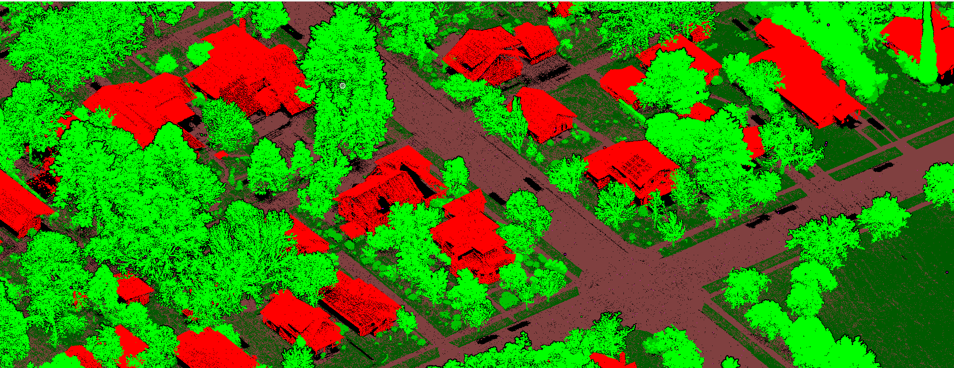
UAV LiDAR classification at 600 ppm density — ground, vegetation, building, powerline and artifacts.
Geoinformatics is a multidisciplinary professional geospatial technology services company with innovative offerings and strategic partnerships with industry leaders in the global space. Innovation is the guiding force for all our services.
We offer services ranging from application development to enterprise integration, consulting, data conversion and capture — including field survey and enterprise system integration projects undertaken with our strategic partners.
Geoinformatics follows a standard methodology for issue escalation, progress monitoring, quality reviews and status reporting. Tasks are planned with mutually agreed milestones, broken down into weekly work segments with regular tele-conference review meetings.
Standardized business practices coupled with software engineering processes
Proven delivery for large private and government organizations
Strategic global partnerships across the geospatial industry
SME-led quality assurance at every project stage
Have a project in mind? Tell us about it and we'll get back to you promptly.
